home>features>viewing tools>3D viewer

data importing modelling viewing tools data exporting administration tools roadnoise article railnoise article sitenoise article

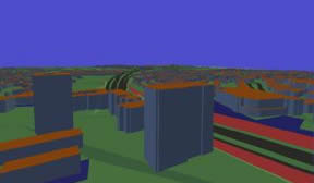
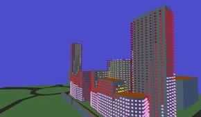
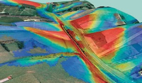
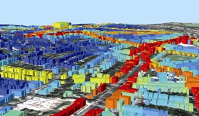
3D Viewer

The 3Dviewer is a powerful tool within the NoiseMap software as shown in the examples below. The 3D viewer enables the user to fly through the full model that they have created. The user has full control of the "flight path" taken, depending on which features they wish to examine.

3D view of the model and terrain

Looking at a noise model in 3D is a very useful tool. It can be used to assist with designing mitigation features such as barriers, and also for showing clients the impact of any elements of a new scheme.

3D view showing facade noise levels

The 3D view can be used to show the facade noise levels as they vary up high rise buildings, information that can not be shown in a flat contoured noise map.

Noise contours exported

This image shows noise contours that have been exported and then overlaid on aerial photography to show the spread of noise from a road. The images were combined using GIS software.

Facade noise levels exported

The grid of noise levels underlying a noise map have been used to assign the facade noise levels to each building. In GIS software the buildings are then coloured and overlaid on maps or aerial photography.


phone: +44 (0) 20 3355 9734